Day 9 Waihi to Te Ahora – 49.5 kms

Tuesday December 17, 2013

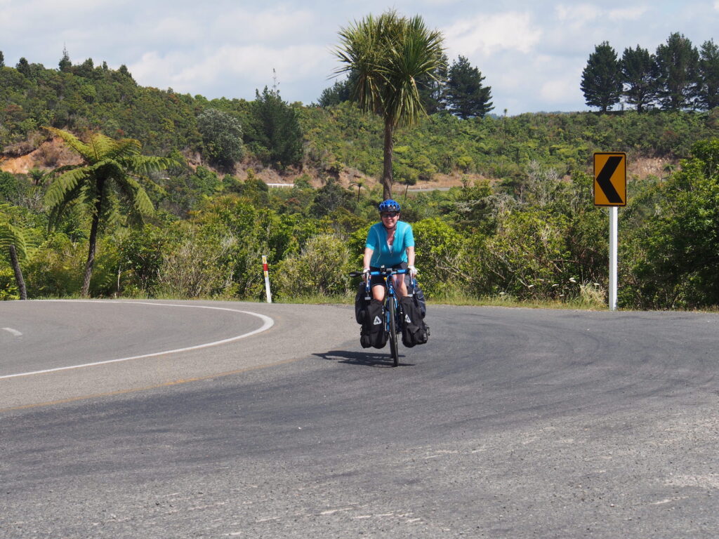
We are actually doing what we said we would do and that is to take each day as it comes.  No planned route, just go where we want to, when we want to.  Absolutely amazing for us both to be so easy going and not even concerned about not planning anything days ahead.

We decided to take the rail trail to Te Arohoa via Paerora.  The trail was a little bit steep to start of with but then went to a very easy ride.

Start of the Rail Trail

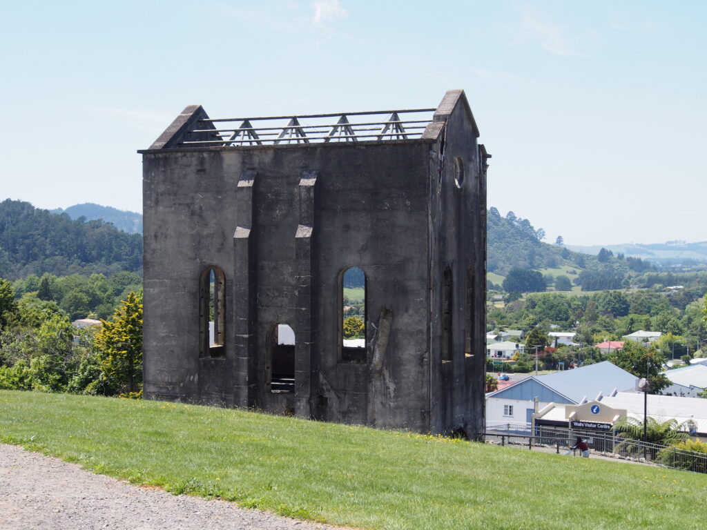
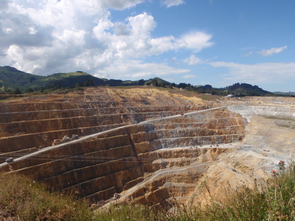
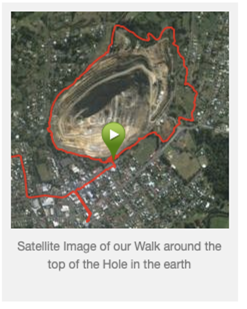
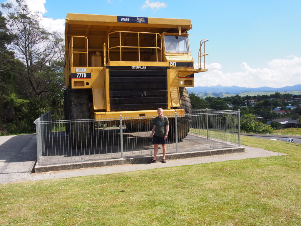
The trail followed the route of the old gold mining trains.  We stopped at an historic site that showed an old Mine site.  The population at this site was over 2000 people in the early 1900\’s.  It had Ore Kilns  a crushing area and an area set aside for cyanide tanks, apparently a New Zealander invented how to use a method to separate the gold from the ore using a cyanide mix.

Old Gold Mine Site

It was a lovely route, along the river to Paerora and the trail was easily managed on the loaded touring bikes.

The Gorge

We had to go through a tunnel which was almost 1 kilometre long, headlights on for the first time.

Tunnel (1 km long)
Bridge after the Tunnel

We stopped in Paerora for lunch which is another Town with a giant roadside attraction.  Paerora is a soft drink similar to sprite but is made with local mineral water.  It tastes good.

Another Giant Attraction

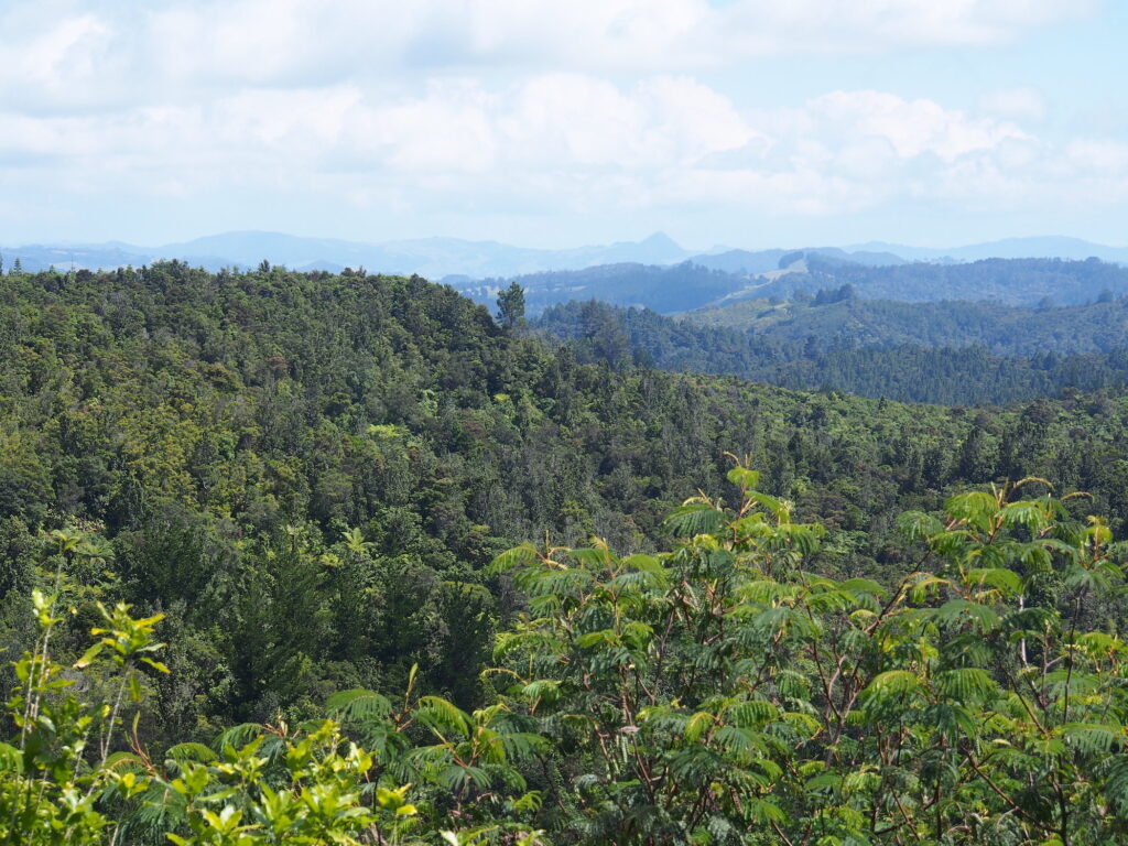
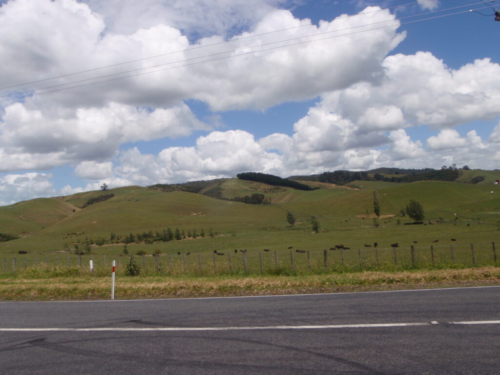
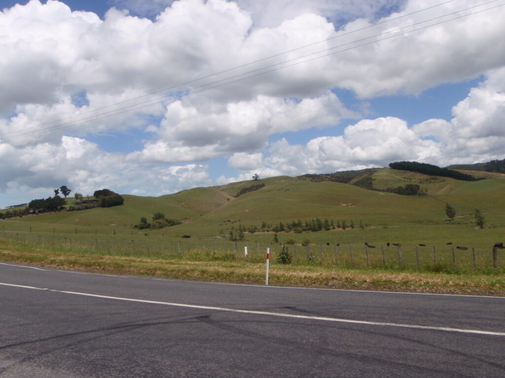
After lunch we carried on to Te Aroha.  The trail was through farming country and we had to cross a lot of concrete cattle grids.

About 8kms outside of Te Aroha we went back on to the road as the rail trail had gone from crushed gravel to a chip and seal covering.  It was harder on the bikes and the riders.  Tonight we are staying in a Youth Hostel for the second time.  The first one had tent sites, this one we are actually in our own room and only costs about $15.00 more than a camp site.

Opposite the Information Centre (iSite) I spotted a Contract Bridge Centre.  ARG (the Amazing Race Gnome wanted to go in and play, but we told him we had to find a room first.

ARG Playing Bridge

Day 8 – Whangamata to Waihi – 33.9 kms

Monday – December 16, 2013

Another lovely ride today.  We were ready to leave the campsite at 8:15 a.m. but remembered we had to get the $10.00 deposit back for a key for the fridge – some campsites have strange rules.  The campsite office didn’t open until 9:00 am, poor planning on our part.  We went to the post office to mail some postcards, yes I am still sending cards via snail mail.  Then went back to the camp site to get our $10.00 back.  We started the ride at 9:00 am.  Again we had some hills, but mostly manageable.  I only had to walk up one of them for a short way.  Today’s scenery was very reminiscent of the Yorkshire Dales.

When we got to Waihi, we were going to have lunch and then carry on to Te Aroha.  However, as we came into the Town, Ralf spotted an old pumphouse and an old mine shaft.

Cornish Pumphouse

Waihi is known as the Town with the Heart of Gold.  We found out why after Ralf went up the hill to the pumphouse and discovered a massive opencast gold mine. It is 250 metres deep – in the centre of Town. Planning permissions?

Open Cast Gold Mine in the Centre of Town

 We decided to stay the night in Waihi and complete the perimeter walk 4kms around the top of the open cast mine.  The massive Tonka Trucks looked like little Tonka trucks as they moved up and down the pit roads.

One of the sayings in the early 1900s was that you could get a house for a thumb.

The mining companies would pay compensation if you injured yourself in the mine.  Miners would often cut off a digit and claim the compensation, then buy a house with the money.

Ralf in front of Tonka Truck

The Town centre also has a lot of murals and bronze statues.  For a mining Town it is very nice.

Bronze – Kids Playing

The first rainstorm of the trip.  We had just got back to the camp site after wandering around the Town and picking up some groceries when the heavens opened.  The tent is waterproof.

We started to make dinner and chatted to another cyclist from Germany (George).  He told us about the Kauraki Rail Trail to Te Aroha via Paerora.  He said the trail was good and very scenic and safe – no logging trucks.  Our route was going to take us to Tauranga and then across country into Rotorua.

Tomorrow we have changed our route, we are going out to Karangahake Gorge along a 21 kms rail trail to Paerora and finishing in Te Aroha about 44 kms total.  It may be slow going as we are on loaded bikes and there is a lot to see.  After that we will be heading down towards Matamata (Hobbiton) and onwards to Rotorua and Lake Taupo.  We decided not to go down the coast road at this time as the roads are getting busier with campers and logging trucks and often the roads are narrow with little or no shoulders.

The beauty of having no set route and no set timetable.  We were able to stop at a really interesting Town with a massive hole in the ground and find out about a different route for tomorrow.


Day 7 – Whitianga to Whangamata – 65 kms

Sunday – December 15, 2013

What a great ride.  We started a little late today (around 9:00a.m.) and were only going to cycle 30 kms to Tairua. We took the ferry over the bay which cut out about 10 kms and one set of hills.  The second hill coming into Tairua was a saddle hill, which basically is a ridge line.  You climb up to the ridge and then are able to cycle for about 10 kms on the ridge and then come down the other side into Tairua. It was lovely riding, rolling hills on the ridge but easily managed.

Climbing up to the Ridge

We got to Tairua at around 11:00 a.m. and decided after a snack for lunch that we would carry on.  After lunch we decided to see if we could get to Whangamata. If we got too tired or hit more hills, we would have been able to cut it short in Opoutere, it had basic facilities with a YHA camp site.  The turn off to Opoutere was about 10 kms short of Whangamata, so we pushed on.  We both felt really good that we could do 65 kms on a hilly section.  The actual elevation gain was more than we had ridden on the Coromandel but the hills were not as steep.

View at the top of the Ridge

Very proud of ourselves today.  Whitianga is a tourist seaside town, Whangamata is a surfing Town.

Surfing Santa

Rest Day – Whitianga

Saturday – December 14, 2013

Now you would have thought that a rest day means, relaxing, lazing around the camp-site (which was very nice) or have a leisurely stroll through a small seaside Town.  Well of course you do not know us very well.  A great rest day means:  A relaxing breakfast, then a nice wander around the Town of Whitianga, taking a small ferry over to Cook’s Bay and walking two hours to a lookout which showed the landing place of James Cook at Mercury Bay.

Lonely and Cooks Bay, NZ

On the walk we spotted a Tui bird, (no photo) they are bigger than a starling, black with odd white feathers sticking out of its chest, a couple of fan tail birds, which are the same size as a goldfinch but have this very elaborate fanned tail and an Oyster Catcher with chicks.

Oyster Catcher with Chicks

We also took a photograph of a Pohutukawa Tree, which is commonly known as the New Zealand Christmas Tree.  They have this bright red flower on them that looks like a big red bauble.

New Zealand Christmas Tree

We have been able to update photos and had a nice relaxing day.

Week 1 Route – Auckland (Papakura) to Whitianga and Thoughts

End of first week thoughts.

  • The Coromandel Peninsula is very hilly.
  • It is very pretty
  • New Zealanders are very friendly and helpful
  • We gain a lot of attention at pull outs (view points)
  • Camp kitchens are great to meet people and discuss new routes, places we should visit, the difference between Canadian intensive farming and New Zealand intensive farming (with Eric from Kitchener/Waterloo area) and even politics with a young German couple (Wolfgang and Kristine).

This Week’s route

Day 5 Coromandel to Whitianga – 45kms

Total Time 6 hours

I do believe we have decided to walk New Zealand!!  Three kilometres uphill to the lookout and we walked 2.5 kms of it.

Half-way up the Hill

The grade varied from 12 % to 18%, impossible to cycle with loaded touring bikes, at least we could not do it.  May be we will come back after finishing the south Island and prove that these hills can be done on a loaded touring bike.

Maungataururu lookout

Looking Back to Coromandel

The rest of the day should have been rolling hills but again they were steep hills and we walked a lot of them.  It is very disappointing for us, but the views are absolutely stunning.  The downhills are absolutely terrifying.  My top speed today was 53.9 kms scary.

Screaming downhill – 54 kph!

We decided to take tomorrow as a rest day.  Whitianga is a lovely seaside town, with lots of services and a couple of nice camp sites.

To see the route to date check out the map in the next post.

Day 4 – Thames to Coromandel – 50.86

Total time 4 hrs 48

As I started the ride this morning I kept reminding myself to remember the first 30 kms, so that when I wrote this blog tonight it wasn’t all about the monster hills again.  The first 30 kms was a beautiful coastal road, with slighty rolling hills, very easy to manage.  The road was a little narrow with no shoulder most of the way but the scenery was stunning.  At Wilson’s Bay the monster hills started.  Up hill for the next 10 kms and then a very fast downhill, up hill for the next 5 kms and then another very fast downhill.  A short flat coastal plains road and then another uphill only 200 metres, then another fast downhill.  The final 10 kms into Coromandel were relatively flat and a nice wide road with a shoulder.  We booked into the YHA and set up camp.  We have another hard ride tomorrow, 40 kms and the first 5 kms are uphill!!  This is exhausting.  I think it might be time to take a day off.


Day 3 – Miranda to Thames -36.4

Time 2 hrs

A very easy day to Thames, Ralf took the lead all the way and were done the 32 kms into Thames in just under 2 hours.  It was a fairly flat ride with a slight head wind.  We stopped in Thames at the information centre and found out about a cheap campsite 3 kms out of town.  We went shopping to get our evening meal and food for the next couple of days.  We will not starve.

Kara who we met yesterday joined us on the ride in and was surprised how quickly we go to Thames. She has given us a couple of websites to check out for campsites.  She is staying two nights in Thames, we are moving onto Coromandel tomorrow.

This campsite has free wi-fi, but only for two hours.  Hoping to get these past few days uploaded but might have to add pictures later.

Day 2 – Orere Point to Miranda Hot Springs – 36.45

Total time 2 hrs 17mins

After yesterdays hilly ride, we decided to take it easy and only cycle to Miranda Hot Springs.  We started with more hills and after a screaming downhill top speed 45 kph we joined the Coast Road a flat road hugging the coastline.  We did have a head wind, and our average speed has dropped from 25-30 kph (in Canada) to (15-19 kph). Partially due to the weight we are carrying and partially because we want this trip to be more relaxing than our usual riding.  We are only by this way once.  We actually stopped and smelled the roses today – not literally but we spotted a Maori Community Hall and stopped to take photos.

Community Hall

Awesome carvings at the entrance and a boat with a scary mast head.

Mast head

We also spotted a giant Oyster catcher, not that you could miss it.  I thought it was only in Canada that had giant road side “attractions”.

 Giant Oyster Catcher

We arrived at Miranda before noon, a very short day of cycling, but we decided to stop anyway and take in the hot springs.  We also met a single female cyclist, Kara, who is also cycling around New Zealand for 3 months – she was from Vancouver and also struggled on the hill yesterday.  We will probably meet up with her again, although Kara is taking a rest day tomorrow in Thames.  We are also only going to Thames tomorrow and then hit the hills again to Coromandel on Thursday.

I am a little concerned about the hills but Betty (MHBC) told me about muscle memory.  Apparently if you have not trained for a while and then start training again your muscles remember.  I thought about this as I was cycling today and I think mine have amnesia.

Day 1 – Auckland to Orere Point-53.5 kms

Total cycling time 3hrs 10mins.

We started the day by buying me a new Garmin bicycle computer.  Birthday and Christmas present from my lovely husband.  I could not get my old Garmin to find a satellite and start to record the days ride.  I struggled with it last night trying to get it to recognize on my computer and went through all the reboots etc, but this morning it still wouldn’t work.

We still managed to catch the 10:15 ferry from Devonport to Auckland Ferry Terminal.  Bikes were free. We then took the train out to Papakura, again the bikes were free.

Leaving Devonport on the Ferry and Auckland Skyline

Now this might seem like cheating on our first day of cycling, but everyone we spoke to recommended us to take the train out of Auckland.  New Zealanders do not think very highly of their fellow car drivers.

At Papakura, we cycled to Clevedon for lunch.  A really nice road-side grocery store, with ready made sandwiches and meals, very good.  We met a couple from France who were also bike touring.  They rented equipment, and managed the hills a lot better than me.  The roads were nice rolling hills until Clevedon, then we hit large hill up to Orere Point.  What a hill, it was 4 kilometres of all uphill with 7%-14% grades.  I really struggled.  Hopefully tomorrow will be better.

Two weeks of lunches and farewell dinners, obviously took its toll.

Beautiful scenery today, lovely quiet bays and rolling farmland.  A transport truck passed us full of sheep, we met him again further down the hill and there were hundreds of sheep all waiting to be shorn.  I even spotted the tree that is represented in everything New Zealand.

Ducks at the campsite